

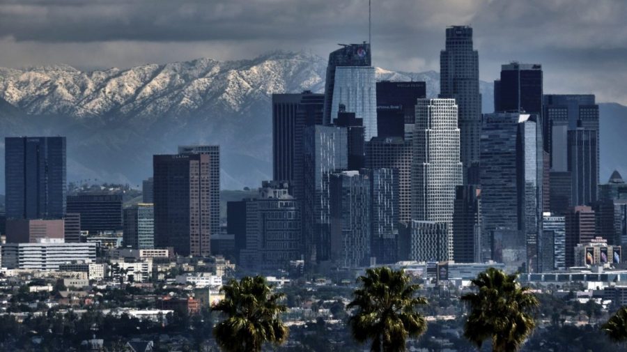
The Los Angeles area’s groundwater remained depleted even after a series of historic atmospheric rivers struck the region in 2023, a study has found.
Record rainfall filled both shallow basins and reservoirs to nearly capacity that year, but drought persisted in the deeper aquifers, according to the study, published Thursday in Science.
The series of storms dumped more than 140 percent of California’s 20th-century average annual precipitation in just three months — with 16 atmospheric rivers occurring from the last day of 2022 through March 2023, the scientists noted. And just half a year later, in August 2023, Hurricane Hilary unleashed a summer deluge and made a considerable contribution to “one of the wettest water years in California’s recorded history,” according to the study.
But even after that year of extreme rainfall, aquifers located 50 meters or more below the surface were not refilled, the scientists found. Unlike shallower aquifers, these deeper vessels regained only about 25 percent of the groundwater they had lost since 2006, according to the study.
“It appears that a single epic storm season is not enough to restore the groundwater depletion accumulated over the recent droughts,” lead study author Shujuan Mao, who conducted most of the research as a postdoctoral fellow at Stanford’s Doerr School of Sustainability, said in a statement.
“It will take many more wet years for the deep aquifers to fully recover,” added Mao, who is now an assistant professor at the University of Texas at Austin.
The Stanford University-led team of scientists drew its conclusion by harnessing the capabilities of the region’s existing network of highly sensitive seismometers.
While that system was created to monitor earthquakes, the researchers were able to use the network’s decades of data to estimate water levels in the area’s aquifers, which altogether serve about 10 million residents of Los Angeles and Orange counties.
In repurposing the existing earthquake monitoring network, Mao and her colleagues developed a new “Seismic Drought Index” for quantifying water deficits at various depths. This tool, they explained, enables high-resolution groundwater measurements via decades of seismic vibrations, which were typically considered to be “noise” by seismologists.
“We can use the ambient seismic vibrations and analyze the speed of seismic waves to sense the aquifers,” co-author William Ellsworth, a Stanford professor emeritus of geophysics, said in a statement.
Such vibrations, Ellsworth explained, are regularly going into the Earth from numerous sources, including wind, ocean waves and traffic. And measurements of slight changes in the speeds of these seismic waves can be used to track groundwater levels.
While measuring groundwater usually requires drilling deep wells — at a price point of $100,000 to $200,000 for a single location — the new approach can assess entire basins at once, at about half a mile in depth and over a period of decades, Mao noted.
“We realized that there was a more affordable way to measure the groundwater dynamics. The seismic infrastructure is already in place and the data has been captured continually for decades,” Mao said. “It’s a buy-one-get-one-free technology.”
Corresponding author Gregory Beroza, a Stanford professor of Earth science, described this technology as “potentially game-changing for groundwater management.”
“It moves us to a possible future where we can measure groundwater recharge — how much there is and where it’s going — much as we do with stream gauges for surface water,” Beroza said in a statement.
The authors expressed hope that their new method could enable water managers to divert more water as needed and refill underground reservoirs, which they said could hold as much as 17 times the volume of California’s surface basins.
Groundwater, the scientists added, is responsible for between 40 percent and 60 percent of the Golden State’s freshwater supply — making a complete assessment of total deficits even more critical.
In some cases, however, the researchers warned that deep aquifers could have already collapsed to a point of no return, amid years of prolonged droughts and historic overuse. Ellsworth cited an area in the southern San Joaquin Valley — Central California’s agricultural hub — as a region that has sunk dramatically over the past several decades, due to groundwater depletion.
“The loss of aquifer storage capacity can be irreversible,” Mao added. “We hope that our method can help water agencies to fill gaps in their monitoring data, refine hydrologic modeling, and inform decisions about water use and conservation.”


