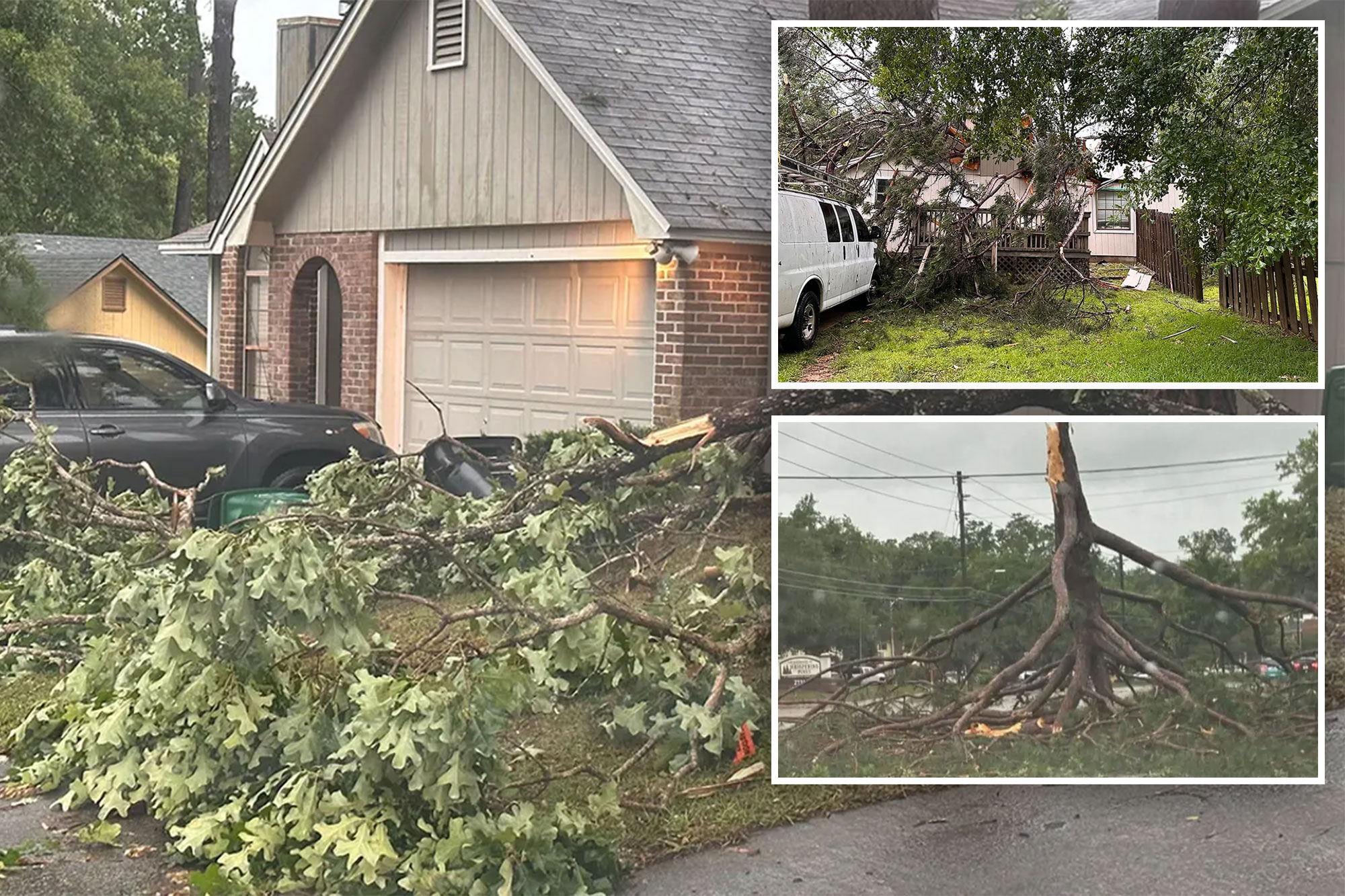
TALLAHASSEE, Fla. – The deadly multiday severe weather outbreak impacting millions across the U.S. stretched into Friday morning as an intense squall line of thunderstorms brought damaging wind gusts across the South and multiple Tornado Warnings to the Tallahassee, Florida area.
Tallahassee Mayor John Dailey told FOX Weather that one person was killed in the storm as the squall line swept across the Florida Panhandle, triggering a variety of severe weather warnings.
“Unfortunately, we have had one confirmed fatality, and we ask everybody to keep their family in your prayers,” Dailey said.
“And, of course, we’re assessing the damage, and we’ll continue to do so.”
According to the FOX Forecast Center, at least four tornadoes were confirmed on radar in Tallahassee, Florida, on Friday morning, while thunderstorms produced gusts as high as 84 mph.
“The reports that I’m receiving is that we had wind gusts between 80 and 100 mph … that’s hurricane strength,” Dailey said.
“It was a significant storm that came through, and what is concerning is we haven’t even gotten into the storm season, per see.”
The National Weather Service will determine the exact number of tornadoes that occurred when they get storm survey teams out into the field later Friday or Saturday.
“We have calls for service all over the county,” Kevin Peters, director of Leon County Emergency Management, told FOX Weather.
“Our county and city responders are responding to 911 calls and making sure people are safe. That’s our first step and our most important step is to make sure people get rescued and are safe.”
Hundreds of thousands lose power in the storms
The NWS reports numerous reports of damage all across Tallahassee around 7 a.m. ET as the squall line was moving through.
NWS forecasters at the Tallahassee office said they had to take shelter and transfer storm warning authority to neighboring offices.
“Dangerous situation unfolding for Tallahassee right now,” the NWS said as Tornado Warnings were in effect.
“Seek shelter immediately. Multiple circulations and radar-confirmed tornadoes apparent on radar.”
Overall, more than 300,000 customers were without power across the South during the peak of the storms as of early Friday morning, with over 200,000 of them in Florida.
The City of Tallahassee said early assessments of the electric grid in the wake of the storms have shown severe damage to transmission lines, impacting 11 substations.
Restoration will possibly take through the weekend.
Mutual aid has been requested, and over 66,000 customers are without service as of 9 a.m. Friday.
Lance Greenfield was in Tallahassee at the time of the Tornado Warning and experienced heavy rain, wind and a massive thunder and lightning show that he said he’s never seen before.
“We just lost power,” he said in a Facebook post.
“Thankfully, I just made my second cup of coffee … fingers crossed.”
Florida State University campuses in Tallahassee are closed Friday due to the impact of the severe weather. Leon County Schools said they were closing due to tornado recovery efforts.
Wind damage reported in Alabama, Mississippi
A 71 mph wind gust was reported in Douglasville, Alabama, with a 62 mph gust in Troy, Alabama as the line of storms swept through overnight.
Numerous damage reports came in from central Mississippi, including toppled trees that trapped residents inside their home in the town of Harmony.
In Clarksdale, there was significant wind damage to a home, including gusts ripping off a power meter and leaving cars and livestock pens in ruins.
Near Meridian, a tree fell onto a semitruck as it traveled along Interstate 59.
So far there are no reports of any injuries from the cluster of storms.
Finally, a break in severe weather
The main squall line pushed offshore as morning turned to midday, and all severe weather watches in Florida have ended.
But some lingering storms have kept occasional heavy showers and thunderstorms dampening the clean-up efforts.
Another round of severe weather is possible later Friday into the afternoon and evening in the coastal Carolinas as some lingering atmospheric instability triggers more thunderstorms, putting Wilmington, North Carolina in a Level 2 out of 5 risk of severe storms from the Storm Prediction Center.
Beyond Friday, the frontal boundary is expected to push offshore, which will allow the region to be thunderstorm-free over the weekend.
It will usher in a relative national calm in the weather with minimal severe weather threats in the forecast for the next several days.


