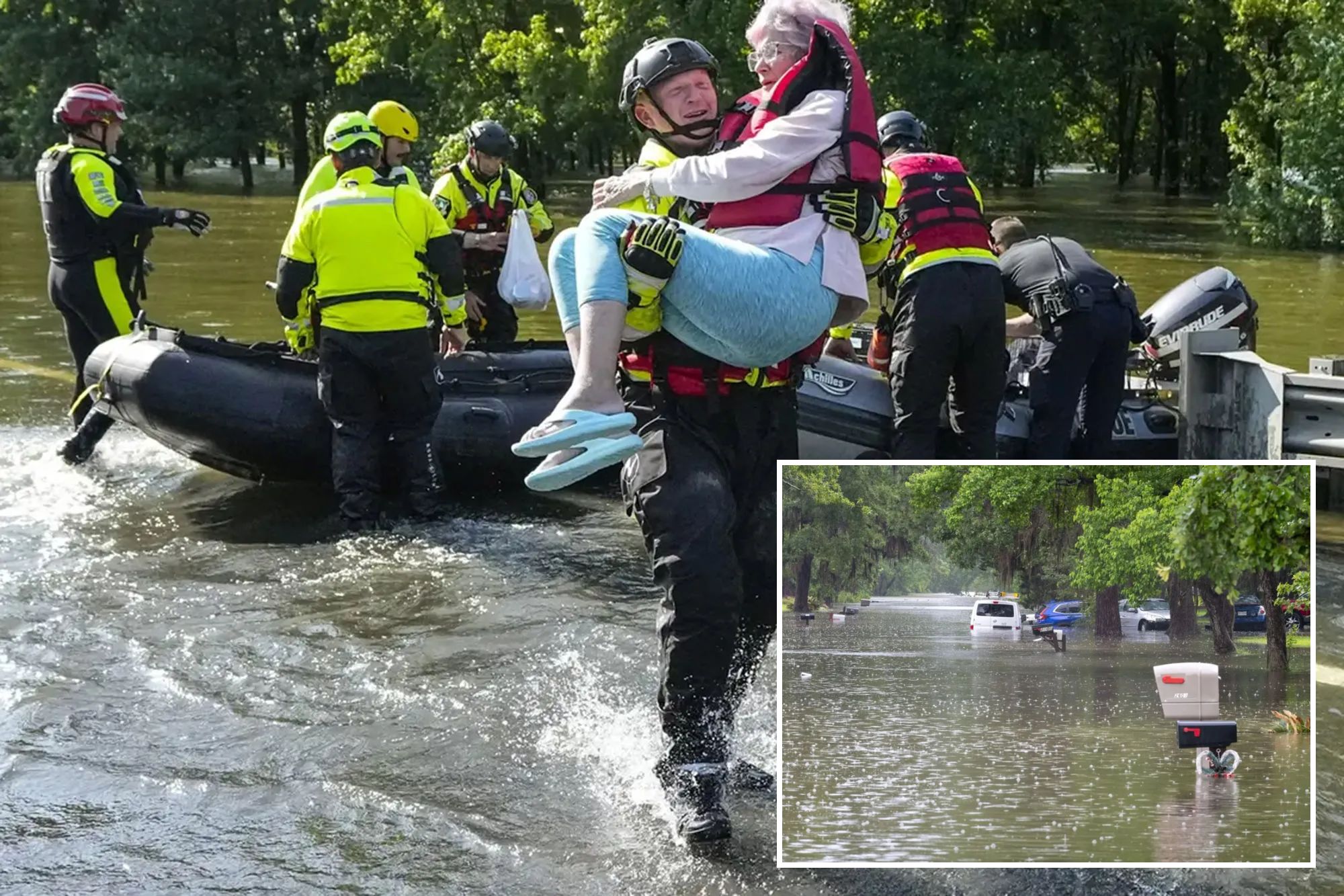
Rescue workers and residents dealing with devastating flooding in East Texas are getting a badly needed break in the weather Saturday, but another round of heavy rain looms for Sunday, prompting extended flood alerts.
With the break in the weather comes the good news that river levels peaked Friday night along the East Fork of the San Jacinto River, which has seen the worst of the flooding, but is forecast to remain well above major flood stage through much of Saturday.
NOAA’s river gauge in New Covey says the river crested just under 78 feet — nearly 20 feet above flood level and only 3.4 feet shy of the record crest set during Hurricane Harvey in 2017.
High waters that reached up to the rooftops of many homes led officials to issue mandatory evacuations along the east side of the river and urged residents not to ride out the storms in their homes.
“That means elevated structures will get water … it means the water will be hitting power lines, which puts our emergency evacuation vehicles at risk because they’re not going to be able to see those power lines,” Harris County Executive Judge Lina Hidalgo said Thursday.
“Please evacuate that area as soon as possible.”
Still, dozens of people and pets needed rescue as crews in boats fanned out across the flooded streets and homes looking for neighbors who needed help evacuating.
Hidalgo said around 700 homes were flooded upriver in Polk County as well, giving a warning of what was to come Friday as that water pushed downstream into northern Harris County.
River flooding was also reported along the western fork of the San Jacinto River near Kirkwood, though not as severe as along the eastern fork.
In San Jacinto County, residents along the Trinity River downstream of the Lake Livingston dam were told to evacuate earlier in the week after the dam had to radically increase its outflow as the upstream watershed collected 17-20 inches of rain within a week.
Widespread storm rainfall totals of 6-12 inches were measured across the rest of the region.
Flood Watches remain posted as more rain eyes East Texas
While Saturday will give the region a chance to wring out and allow rivers a chance to recover, more rain is in the forecast for Sunday as a storm system spreading severe weather in the Plains on Saturday continues to push east.
Flood Watches remain in effect for Houston and the flooded areas of East Texas into Sunday afternoon.
Only isolated showers and thunderstorms are expected Saturday, but more widespread heavy rain and thunderstorms are forecast for Saturday night into Sunday.
Additional rainfall totals of 1-3 inches are likely with some spots receiving as much as 5 inches of rain.
As a result, NOAA’s Storm Prediction Center has kept the region at a Level 2 out of 4 risk for flash flooding into Sunday.
The current forecast for the eastern fork of the San Jacinto river shows a slight slowing of the water’s rate of recession later this weekend, but so far still keeps river levels dropping despite the potential for added rain.
The long range forecasts are trending much drier and warmer for the region beginning Monday with mostly sunny skies and highs near 90 for the workweek ahead.


