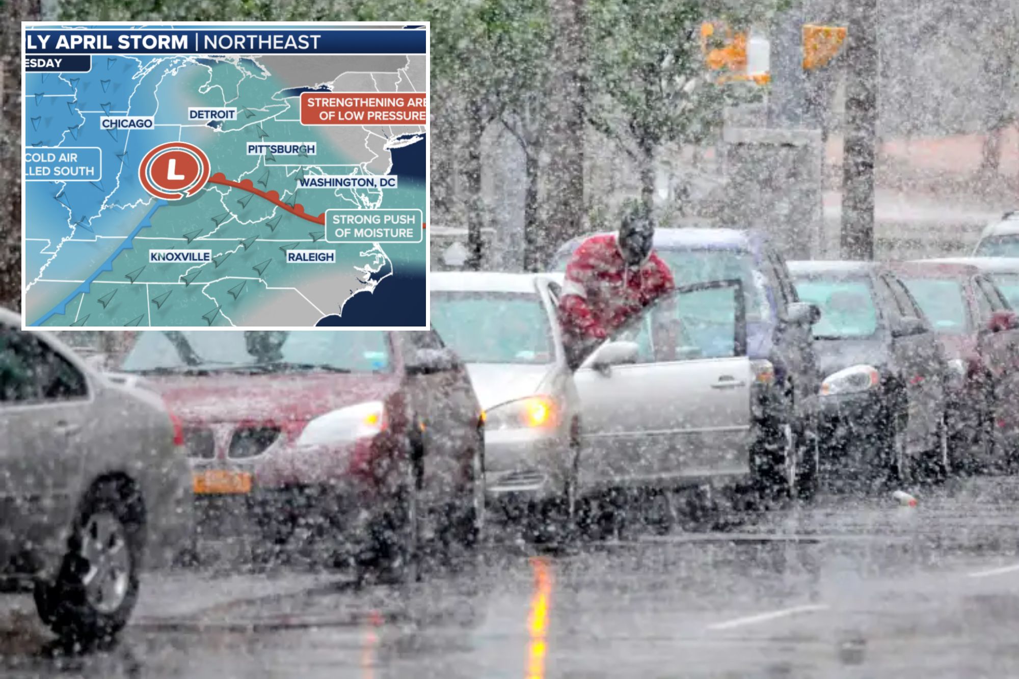
Heavy snow appears to be headed for the Great Lakes, interior Northeast and New England starting midweek.
“We’re talking by Wednesday, Thursday, looking at the potential for maybe up to 3 inches of rain for the mid-Atlantic,” said FOX Weather Meteorologist Craig Herrera. “The big-time snow event could be going on across New England.”
Coast-to-coast storm charges east
The storm system behind the snowy forecast has already been very busy. It started in California and soaked the opening day for the San Diego Padres on Saturday.
One fan had to use her third baseman Manny Machado-face cutout as an umbrella waiting to get into the park.
Monday, the storm reforms on the eastern side of the Rockies and pulls in warm, humid air, which is fuel for severe thunderstorms and tornadoes across the central US.
On Tuesday, the Great Lakes and Northeast are still on the warm side of the storm, so look for rain in Chicago and Detroit early in the day.
Michigan and Wisconsin will turn wintry as cold air filters into the US, changing rain over to sleet first, then to freezing rain and finally to snow Tuesday evening.
Still, ahead of the storm, Syracuse and Boston are both rainy, with only higher-elevation snow across New Hampshire and Vermont.
“The active weather on Tuesday will only be Round 1 as the stationary front begins to fall apart,” the FOX Forecast Center said. “As we progress into Wednesday, the main low will start to linger around the Great Lakes. It is at this time that the forecast becomes more complicated.”
Fox Weather
That initial storm wobbles and peters out while a new coastal low forms in the mid-Atlantic.
“The evolution of the coastal low remains unclear, but all signs suggest that it will greatly enhance the rain, snow and wind on Wednesday and into Thursday,” the FOX Forecast Center continued. “The track and strength of the coastal low will ultimately determine how severe the impacts will be along the I-95 corridor as well as how much snow will fall in New England.”
Tuesday
Rain moves into much of the Midwest to the Northeast.
Severe storms with damaging winds, hail and possible tornadoes threaten the Ohio Valley into the Appalachians.
REUTERS
Late in the day, snow starts to mix in across the Midwest and Great Lakes. Watch for a very dangerous period of sleet and freezing rain in Michigan for the late Tuesday commute before the snow takes over.
The Ohio Valley and mid-Atlantic could get 2-3 inches of rain in some areas, bringing the chance of flash flooding into Wednesday.
The FOX Weather Center said the timing of the heavy snow is still up in the air, noting it could start as early as Tuesday night or hold off until Wednesday.
Wednesday
The coastal storm starts to take shape by Wednesday near the mid-Atlantic.
“What does that do?” Herrera said. “Well, right now it looks like it goes up the coast, and then we could be talking a lot of winds coming in from the northeast, and we could be dealing with some snow across portions of New England and some heavy rain.”
Computer weather models still differ on the placement and strength of the low. Forecast details will be refined as Wednesday approaches.
According to the FOX Forecast Center, there is potential for the low to develop into a major coastal storm.
That could spell more heavy rain and snow closer to the Interstate 95 corridor, as well as gusty winds along the coast.
Thursday
Gusty winds will batter much of the Northeast. Again, who gets snow versus rain along the I-95 corridor depends on the actual track and strength of the storm.
With so many factors at play this week, it is too early to forecast the most probable outcome.
Snow continues to fall across New England on Thursday. If the low lingers off the New England coast, it could rapidly strengthen into a major storm like a nor’easter.


